The Niagara River is a 12,000 year old feature, where a world-class volume of water flows, falls, cuts, and flows again as it travels between Lake Erie to Lake Ontario.
I felt inclined to take the time this week to paint a picture of one of Niagara-on-the-Lake’s most discrete but irreplaceable ecosystems. Actually, I am surprised I haven’t written about this in the past.
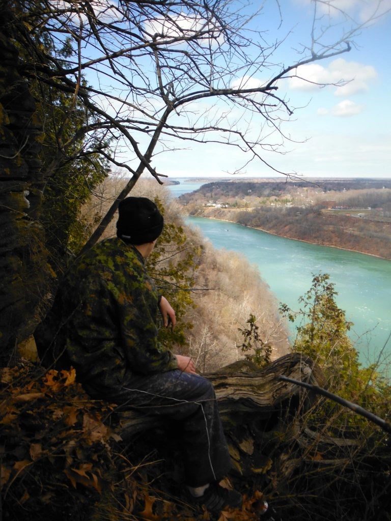
The geographical nature of the land upstream of Niagara Falls is significantly different than the features we see down below in NOTL. Upstream and closer to Lake Erie, the river is broad, shallow, and nearly level with the surrounding dry land.
At Niagara Falls, once the 3,160 tons per second of water plummets over 50 metres into the cauldron below, it moves with serious momentum through the Niagara Gorge. Given that the gorge naturally diminishes at the edge of the Niagara Escarpment near Queenston, this is where the river slows down again into its most ancient stretch through NOTL.
The cliffs on NOTL’s side of the river are the oldest carved formations on the river’s banks to date. That means the river bank at Navy Hall is actually a more ancient drop-off than the towering rock faces of the Niagara Gorge.
Globally speaking, with an example right under our noses here in NOTL, there exists a theme of rugged areas that have been spared development due to their inaccessibility. These riverside slopes fall into that exclusive category.
For the vast majority of land along the Niagara River in NOTL, it is a human-developed landscape of private properties and dwellings. Such areas once hosted bloody battles over the times, from Indigenous territory feuds thousands of years ago, to the War of 1812 featuring names such as Sir Isaac Brock and Laura Secord.
However, even with such a busy landscape, the steep and wooded banks of the great river have stood the test of time relatively uninterrupted. This often over-looked (literally from above, and figuratively on paper) drop-off into the river below serves as an invaluable habitat corridor for wildlife.
Much of this ribbon of green is simply too sheer and jungly for anyone to properly explore it for leisure or scientific purposes. A lot of this forested slope also technically belongs to the various private properties that flank the Niagara River, which further occludes its importance and accessibility.
Personally speaking, the areas I have attempted to penetrate and explore have revealed a multitude of unique microhabitats.
Fresh water seeps out the base of the cliff into the wide and mighty turquoise waterway. Hidden little waterfalls cascade their way down to the shore, and perhaps only flow in the spring time.
Hundreds of old growth trees dot the wall of greenery, subtly advertising their hollow chasms, fit for bird and mammal nesting sites. This is all too important, as the Niagara River water course was declared a Globally Important Bird Area in 1996, the first designation of its kind in all of North America.
This is also a relic habitat corridor where large mammals and other terrestrial creatures can migrate in peace while avoiding human conflict up above.
Considering how little we see of this cryptic habitat feature, we can’t negate how large it actually is.
If the bank of the river in NOTL is on average 20 metres (0.02 km) high, and therefore wide, and the Niagara River from Queenston to downtown NOTL is about 11 km long, we can calculate that this habitat feature takes up about 0.22 km squared, or nearly 55 acres of natural land within NOTL’s municipal borders.
We have all driven by this natural heritage feature, or maybe we got a quick glimpse of in locations like Browns Point along the Niagara Parkway or on top of the bluffs near Navy Hall.
At the end of the day, the ultimate way to appreciate the fragile, but bold contiguity of this cliffside ecosystem is from the water, where you can see this environment for what it is worth.